
Home > Apps > Maps & Navigation > 2GIS: Offline map & navigation

2GIS: Offline map & navigation
Feb 11,2025
| App Name | 2GIS: Offline map & navigation |
| Developer | 2GIS |
| Category | Maps & Navigation |
| Size | 180.4 MB |
| Latest Version | 6.44.1.559.3 |
| Available on |
4.1


2GIS: Your All-in-One Offline Navigation and City Guide
2GIS offers comprehensive mapping and navigation solutions for drivers and pedestrians, seamlessly integrating offline maps, GPS navigation, live traffic updates, parking assistance, public transit routing, and a wealth of city information. Access it online or download maps for offline use, ensuring you never lose your way.
Navigate with Ease, Even in Unfamiliar Territories:
- Effortless Location Discovery: Quickly find addresses, businesses, phone numbers, operating hours, products, and services.
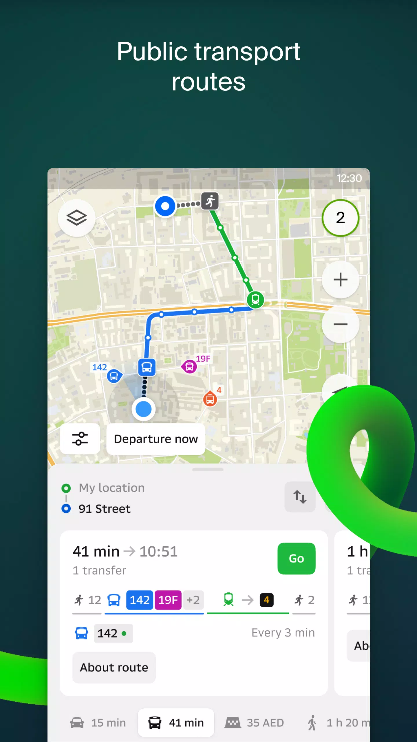
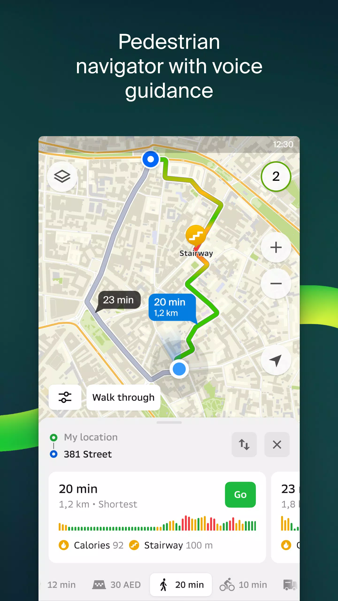
- Multimodal Routing: Plan your journey by car, bus, subway, or on foot, utilizing detailed navigation guidance.
- Convenient Location Details: Easily identify building entrances and nearby parking options.
Key Features:
- Precise Mapping: Access detailed maps showcasing districts, buildings, streets, public transit stops, gas stations, and more.
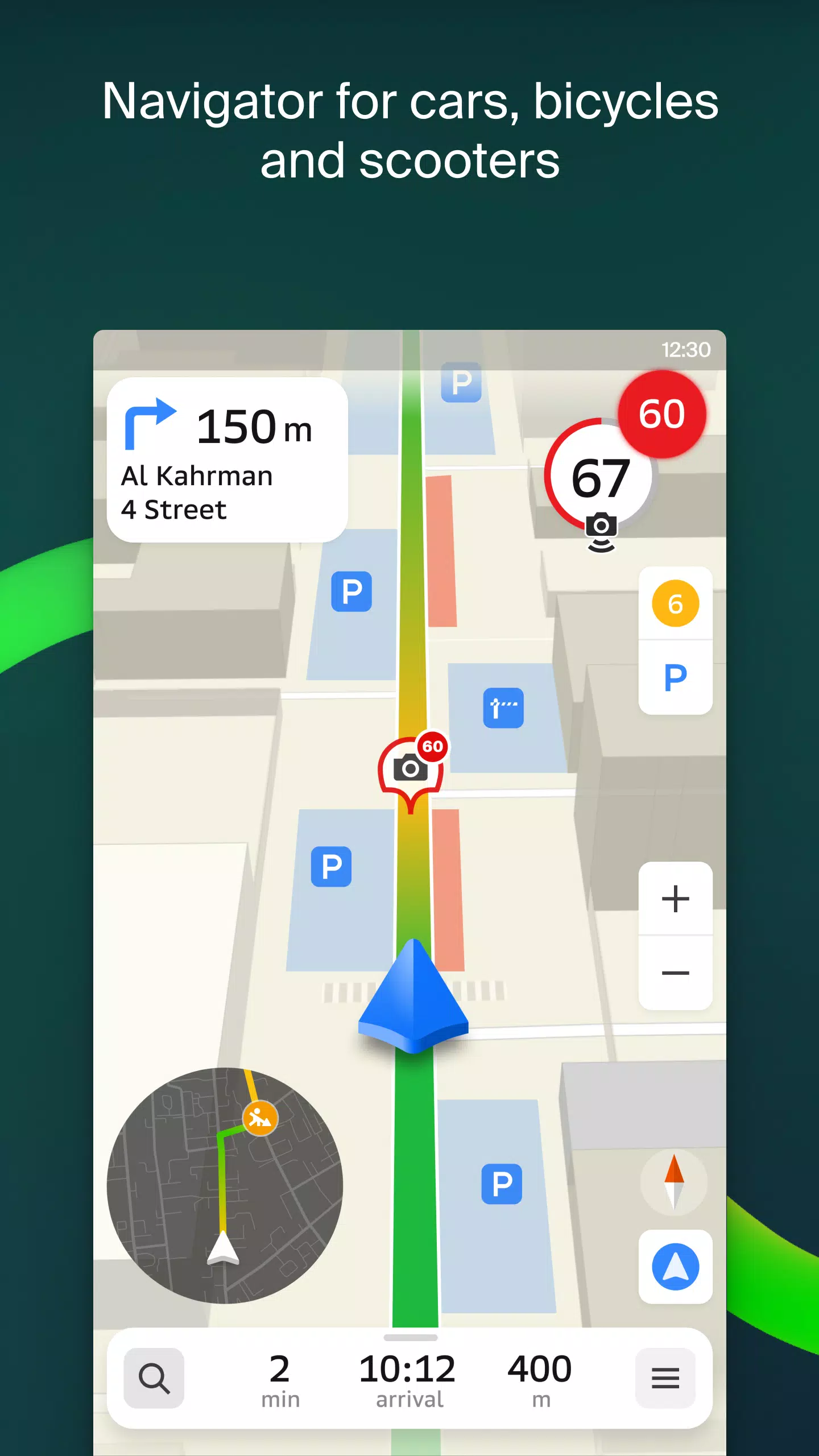
- Advanced GPS Navigation: Benefit from real-time traffic updates, hazard alerts (speed cameras, toll roads, unpaved roads), and multi-point route planning. Includes a free Android Auto app.
- Live Location Sharing: Share your location with friends and family for safety and peace of mind, complete with fun stickers and battery level indicators. Control sharing settings for privacy.
- Real-Time Road Incident Reporting: Stay informed about accidents, road closures, and speed cameras through user-reported incidents and comments.
- Comprehensive Public Transit Information: Access up-to-date schedules and routes for public transportation.
- Pedestrian-Friendly Navigation: Enjoy background walking navigation with voice guidance.
- Specialized Truck Navigation: Plan routes optimized for trucks, considering vehicle and cargo specifications.
- Extensive City Directory: Find addresses, entrances, postal codes, phone numbers, operating hours, social media links, websites, and user-submitted photos and reviews.
- Integrated Travel Guide: Discover points of interest, Wi-Fi hotspots, and more directly on the map.
- Wear OS Companion App: Use the Wear OS companion app for convenient on-the-go navigation (Wear OS 3.0 and later).
Map Coverage:
2GIS provides extensive map coverage across various regions, including:
- United Arab Emirates: Dubai, Sharjah, Abu Dhabi, Al Ain, Ajman, Ras Al Khaimah, Fujairah, Umm Al Quwain, Dibba Al Fujairah, Khor Fakkan, Kalba, Al Salamh, and more.
- Russia: Moscow, Saint Petersburg, Novosibirsk, Ekaterinburg, Krasnoyarsk, Chelyabinsk, Ufa, Omsk, Kazan, Perm, Nizhny Novgorod, Sheregesh, and many others.
- Belarus, Kazakhstan, Uzbekistan, Azerbaijan, and Kyrgyzstan: Minsk, Pavlodar, Semey, Aktau, Aktobe, Almaty, Nur-Sultan, Bishkek, Karaganda, Kokshetau, Kostanay, Osh, Baku, Tashkent, and more.
Support: [email protected]
Post Comments
Top Download
Top News
-
 Stalker 2: List Of All The Artifacts & How To Get Them
-
 Trainer's Pokémon Set to Resurface in Pokémon TCG in 2025
-
 Clash of Clans Unveils Town Hall 17: Game-Changing Update Released
-
 Breaking: Ubisoft Unveils Covert NFT Gaming Venture
-
 Shadow of the Depth: Open Beta Now Available on Android
-
 Fix Join Error in Black Ops 6: Different Version